
The 5-Day Mauna Kea & Big Island Itinerary: The Health-Smart Version

A 5-day Big Island loop that pairs Kona coast time, Hawaii Volcanoes National Park, and a Mauna Kea summit sunset into one route, built around the trip's real health hazard: going from sea level to 13,803 feet, the highest point in the Pacific, in a single afternoon. The University of Hawai'i requires every visitor to stop and acclimatize for at least 30 minutes at the 9,200-ft Visitor Information Station before continuing to the summit, and bars anyone who has been scuba diving in the previous 24 hours, is pregnant, or has significant heart or lung disease from going higher. CDC's high-altitude travel guidance notes that acute mountain sickness symptoms can appear within hours of rapid ascent even without an overnight stay, which is why the summit day here is sequenced deliberately rather than squeezed in.
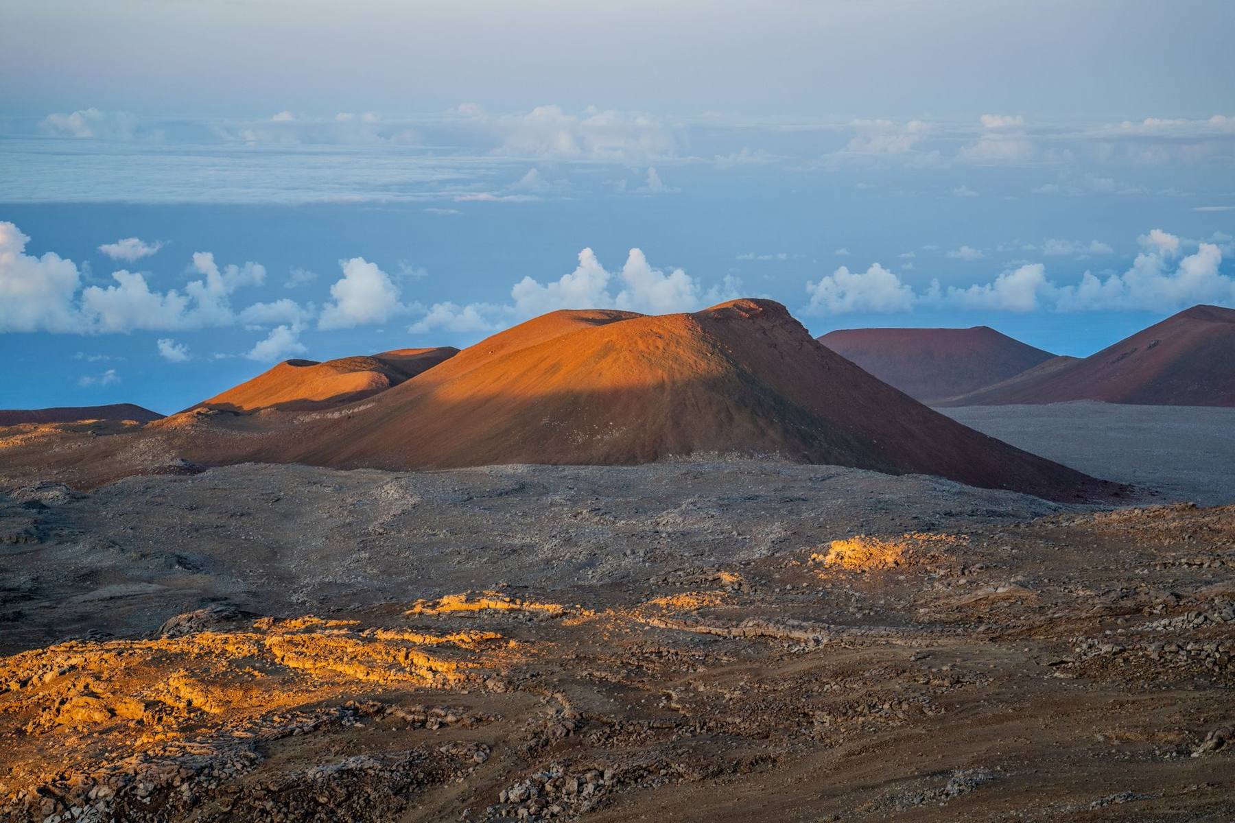
Going from a Kona beach to the highest point in the Pacific happens faster on the Big Island than almost anywhere else on earth. This 5-day loop treats that fact as the itinerary's spine rather than an afterthought: two days at sea level to settle in, a day crossing the island through Hawaii Volcanoes National Park, and a deliberately sequenced summit day built around the acclimatization stop the mountain's managers require of everyone. The reward, a sunset above the clouds at 13,803 feet followed by some of the clearest stargazing in the world, is worth the planning. The altitude is not optional scenery here, it is the trip's central health decision, and it is also what makes this itinerary different from a generic "Big Island in five days" post: the route order, the overnight stops, and even which day you drive Saddle Road are built around when your body is ready for the summit, not just which sights are closest together on a map.
Who this itinerary is for
This route suits active travelers comfortable with a fair amount of driving, roughly 200-250 miles round trip across the island over five days, who want both the classic Kona coast experience and the Big Island's two marquee natural sites, Hawaii Volcanoes National Park and the Mauna Kea summit. It pairs well with our broader United States travel health guide if you're routing through other parts of the country on the same trip. First-timers to high altitude should take the acclimatization stop seriously rather than treating it as a bureaucratic checkbox; the same physiologic drop in oxygen that affects trekkers spending days climbing into thin air can affect a fit traveler on a single fast ascent, just compressed into hours instead of days.
Families with children under 16, anyone pregnant, and travelers with significant heart or lung disease should plan to stop at the Visitor Information Station and not continue to the summit, per University of Hawai'i guidance. Everyone else should budget an honest 30-60 minutes at 9,200 feet before going higher, not the bare legal minimum.
This is not a trip for travelers who want zero driving. Between the Kona-to-Volcano crossing and the Volcano-to-summit-and-back drive, you're looking at several hours behind the wheel on mountain roads, some of it after dark on the descent. If that sounds like more logistics than vacation, a guided summit and stargazing tour removes the driving and the rental-car-agreement question in one step, at the cost of a fixed schedule.
The route
The loop starts on the Kona side, where most international and mainland flights land, and spends two days at or near sea level: a day to arrive and reset the clock, and a day for reef time and the Kona Coffee Belt. From there the route crosses the island on the Daniel K. Inouye Highway, known locally as Saddle Road, which runs between Mauna Kea and Mauna Loa toward Hilo. A detour to Akaka Falls and an afternoon in Hawaii Volcanoes National Park (Kilauea overlook, Thurston Lava Tube) fill day three, with an overnight near Volcano village.
Day four is the fulcrum: a slower park morning, then the drive back toward Saddle Road and up to the Visitor Information Station for the mandatory acclimatization stop, followed by the summit push for sunset and stargazing. The loop closes in Hilo on day five, with a farmers market and a waterfall or garden before departure. Reversing the direction works just as well; the point is that the altitude day sits after two to three days of lower-elevation acclimatization, not on arrival.
Travelers with an extra day can swap the Kona coffee-belt afternoon for a drive up the Hamakua Coast to the Waipio Valley lookout, or add a second night in Hilo to see the Big Island's wetter, greener side properly. Either substitution keeps the core structure, sea level, then Volcanoes, then the summit, intact.

Day-by-day plan
Day 1: Arrive Kona, settle at sea level
Land at Kona International Airport (KOA) and check into a Kohala Coast or Kailua-Kona property. Keep the rest of the day light, a beach walk, an early dinner, an early night. Hawaii runs on Hawaii-Aleutian Standard Time, 5-6 hours behind the US East Coast, so treat this like any eastbound-to-westbound jet lag: get daylight exposure and avoid stacking a big activity on top of travel fatigue. Kailua-Kona itself is worth a slow first evening, the historic Ali'i Drive waterfront and Kailua Pier, where the Ironman World Championship starts each year, make for an easy jet-lagged stroll without needing a car.
Day 2: Kona coast reef time and the coffee belt
Spend the morning snorkeling the Kona coast or booking a guided manta ray night snorkel, one of the Big Island's signature experiences, then head up into the Kona Coffee Belt on the slopes above town for an afternoon farm tour. The belt's volcanic soil and cloud cover between roughly 800 and 2,500 feet of elevation is what makes Kona coffee distinct, and most farms along the route offer short tastings and tours. Hawaii's reef-safe sunscreen law bans oxybenzone and octinoxate statewide, so pack mineral sunscreen before you arrive rather than assuming any drugstore shelf will have it.
Day 3: Cross the island to Hawaii Volcanoes National Park
Drive Saddle Road across the saddle between Mauna Kea and Mauna Loa toward Hilo, roughly a 90-minute to 2-hour drive from Kona-side resorts. Stop at Akaka Falls, a roughly 442-foot cascade reachable via a short, paved loop trail, then continue into Hawaii Volcanoes National Park for the Kilauea overlook and the Thurston Lava Tube, a walk-through lava cave formed by a flowing river of molten rock centuries ago. Kilauea is one of the most continuously active volcanoes on earth and vents sulfur dioxide, which the park calls vog, around the clock; travelers with asthma or COPD should check posted air quality at overlooks and carry rescue medication. Overnight near Volcano village.
Day 4: Volcanoes NP, then the Mauna Kea summit
Take the morning slower, steam vents, the Devastation Trail, a coffee stop in Volcano village. Then drive back toward Saddle Road and up the paved spur to the 9,200-ft Visitor Information Station. This is the health hinge of the whole trip: stop here for at least 30-60 minutes before continuing, regardless of how strong you feel. The summit road beyond the station gains roughly 4,600 feet over about 8 miles, much of it unpaved with grades exceeding 15%, and requires a 4WD vehicle with low range; rangers check and turn back anything else. CDC's high-altitude travel guidance classifies risk by rate of ascent and sleeping elevation rather than by country, and a same-day jump of this size, from sea level to well above 13,000 feet, falls well outside what graded-ascent guidance for overnight trekking would ever recommend if it were spread across multiple days; the acclimatization stop exists precisely to offset that compression.
Want the health prep for United States?
Get a 60-second pre-trip check: the vaccines, prescriptions, and altitude/seasonality notes that change the plan — built for your exact dates.
Time the drive to reach the 13,803-ft summit for sunset, then stay for stargazing, Mauna Kea's summit sits above roughly 40% of the atmosphere's mass and its water vapor, which is why it hosts some of the world's major observatories, and why the night sky here is dark enough to see the Milky Way's structure with the naked eye. Descend the same night; there is no visitor lodging above the station. Overnight in Waimea or back in Hilo. If anyone in your group develops a headache, nausea, or dizziness that does not ease within 30 minutes of arriving at a given elevation, treat that as a signal to descend rather than push on, on this itinerary, going back down is always the fastest available treatment.

Day 5: Hilo and departure
Spend the morning at the Hilo farmers market and Rainbow Falls or Liliuokalani Garden, then depart from Hilo International Airport (ITO) or drive back to Kona for an afternoon flight. The Hilo farmers market runs several days a week and is a good source of local produce and coffee to take home; check current days before you build your morning around it. If you swam in any freshwater stream, pond, or waterfall earlier in the trip, keep that in mind for the next month: leptospirosis has an incubation period long enough that fever, severe headache, or unusual fatigue can show up after you're already home, and it is easy to forget to mention the freshwater swim to a doctor back on the mainland if you don't flag it yourself.
Health prep for this trip
The prep for this trip is short but specific, because the risk here is altitude physiology and sleep disruption rather than infectious disease. Roughly two to three weeks out, talk to a provider about acetazolamide for the summit day, particularly if you have a prior history of altitude headache, or if a rapid sea-level-to-13,803-ft ascent concerns you. Acetazolamide is dosed to start the day before ascent under typical prescribing guidance, so timing it around day 4 means starting on day 3, not the morning you leave for the summit. The Mauna Kea & Big Island travel-medicine bundle covers this and the other two prescriptions below in a single visit.
Hydroxyzine is worth discussing if jet lag from the mainland or altitude-disrupted sleep is likely to be an issue, and ibuprofen covers the altitude headaches and long hiking or driving days that come with this itinerary. None of this trip's medical kit addresses mosquito-borne disease, Hawaii carries no malaria or yellow fever risk, so the entire kit is built around altitude and sleep. Routine vaccinations should be up to date as they would be for any US domestic trip; there is no destination-specific vaccine requirement here.
One week out, confirm your rental car agreement actually permits the Mauna Kea summit road; many standard contracts prohibit it, in which case a guided summit tour is the practical substitute. It's also worth checking the Mauna Kea Weather Center's forecast a day or two before your planned summit day, since a closure can mean rearranging which day you drive up rather than skipping the summit entirely if you've left a buffer.
What to pack
Reef-safe mineral sunscreen (required by state law and not always available for purchase locally), a genuinely warm layer and gloves for the summit, where temperatures can sit near or below freezing even when the coast is 80°F, sturdy shoes for lava rock and wet trails, and your travel-medicine kit with any prescribed acetazolamide, ibuprofen, or hydroxyzine packed in carry-on rather than checked luggage. A refillable water bottle helps with hydration on both the humid coastal days and the dry summit air, and a headlamp or flashlight is genuinely useful for the descent from the summit after dark. If you plan to hike near lava fields or lava tubes, closed-toe shoes with real tread matter more than they would on a typical beach vacation packing list.
Best time to go and what to avoid
Rangers close the road above the Visitor Information Station without much notice when snow, ice, or high wind make it unsafe, and this happens most winters, sometimes with several inches of snow accumulating at the summit ridge overnight. Building a buffer day, or simply not scheduling the summit for your only full day on the Hilo side, protects the trip against a closure. The coastal side of the island rarely sees weather severe enough to disrupt the Kona or Volcanoes NP portions of the trip; the summit road is the one genuinely weather-dependent leg of this itinerary.
Cost expectations
Expect the Big Island to run comparably to other US mountain or coastal destinations rather than an international trip: rental car, mid-range lodging split between the Kona and Hilo/Volcano sides, park entrance fees, and either a guided summit tour or your own 4WD rental if the road is open. Hawaii Volcanoes National Park currently charges $30 per private vehicle for a pass valid seven days, per the National Park Service fee schedule, a minor line item next to lodging and the rental car. A 4WD vehicle capable of the summit road typically costs more to rent than a standard sedan, which is worth weighing against a guided summit and stargazing tour that bundles transportation, cold-weather gear, and a driver who already knows the road. Neither option is dramatically cheaper than the other; the choice mostly comes down to whether you would rather drive it yourself or hand that part of the day to someone else.
Day-by-day plan
| Day | What you're doing | Health note |
|---|---|---|
| 1 | Arrive Kona, settle at sea level Land at Kona (KOA), check into a Kohala Coast or Kailua-Kona property, and spend the afternoon at sea level. | Hawaii runs on Hawaii-Aleutian Standard Time, 5-6 hours behind the US East Coast and 2-3 behind the West Coast. Plan a light first day and get outside in daylight to reset your clock before the summit push later in the trip. |
| 2 | Kona coast: reef, reef safety, and coffee belt Morning snorkel off the Kona coast (or a guided manta ray night snorkel), afternoon in the Kona Coffee Belt above Kailua-Kona. | Hawaii's reef-safe sunscreen law (mineral-based, no oxybenzone or octinoxate) applies statewide; pack accordingly since not every hotel shop stocks compliant sunscreen. |
| 3 | Cross the island: Saddle Road to Hawaii Volcanoes National Park Drive the Daniel K. Inouye Highway (Saddle Road) toward Hilo, detour to Akaka Falls, then into Hawaii Volcanoes National Park for the Kilauea overlook and Thurston Lava Tube. Overnight near Volcano village. | Kilauea vents sulfur dioxide continuously; the National Park Service posts real-time vog (volcanic smog) advisories at overlooks. Anyone with asthma or COPD should carry rescue medication and be ready to skip an overlook if posted air quality is poor. |
| 4 | Volcanoes NP, then the Mauna Kea summit A slower morning in the park (steam vents, Devastation Trail), then the drive back toward Saddle Road and up to the 9,200-ft Visitor Information Station for a mandatory acclimatization stop before the final push to the 13,803-ft summit for sunset and stargazing. | This is the trip's key health day. Stop at the Visitor Information Station for at least 30-60 minutes before going higher, and turn back if you develop a headache, nausea, or dizziness that does not settle. Acetazolamide, started the day before, blunts this response for most travelers. |
| 5 | Hilo and departure Hilo farmers market and Rainbow Falls or Liliuokalani Garden in the morning, then depart from Hilo (ITO) or drive back across the island to Kona (KOA) for an afternoon flight. | If you swam in any freshwater stream or waterfall earlier in the trip, note the exposure. Leptospirosis has an incubation period of up to a month, long enough that symptoms like fever or severe headache can appear after you're already home. |
Frequently Asked Questions
Not everyone does. Acetazolamide is commonly used by travelers going from sea level to the 13,803-ft summit in a single day, since CDC guidance notes altitude symptoms can appear within hours of rapid ascent even on a same-day round trip. Most travelers should discuss it with a provider, especially anyone with a prior history of altitude headache or nausea.
No. Summit visits are day or evening trips; there is no visitor lodging above the Visitor Information Station, and most people descend the same night after sunset and stargazing.
Yes. University of Hawai'i policy requires every visitor to stop and acclimatize for at least 30 minutes at the 9,200-ft station before continuing, and the mountain's rangers turn back vehicles without 4WD past that point.
University of Hawai'i guidance advises against continuing to the summit for anyone who is pregnant, has significant heart or lung disease, is under 16, or has been scuba diving in the previous 24 hours, due to decompression risk at altitude.
No. The road above the Visitor Information Station gains roughly 4,600 feet over about 8 miles, includes unpaved sections and grades over 15%, and requires 4WD with low range; many standard rental agreements prohibit it outright, so check your contract or book a summit tour.
Tap water is generally safe throughout Hawaii. The bigger freshwater concern is swimming in streams, ponds, or waterfalls, where leptospirosis risk is real, roughly half of the small number of US cases each year are linked to Hawaii, so avoid freshwater swimming with open cuts.
No. Hawaii carries no malaria or yellow fever risk, so this itinerary's medication kit is built around altitude and sleep, not mosquito-borne disease.
Vog is volcanic smog, mostly sulfur dioxide, that Kilauea emits continuously. Most travelers should have no trouble at posted overlooks, but people with asthma or COPD should check the park's air quality postings and carry rescue medication.
Mark Karam, PA-C is a board-certified Physician Associate with emergency and urgent care experience and co-founder of Wandr Health.