
The 9-Day Tajikistan Itinerary: The Pamir Highway, The Health-Smart Version

A 9-day Pamir Highway loop out of Dushanbe through the Wakhan Valley to Murghab and Karakul Lake, built around one fact that shapes everything else: the M41 spends three straight nights above 3,500 m and crosses Ak-Baital Pass at 4,655 m, the highest paved point in the former Soviet Union. CDC's Yellow Book caps sleeping-altitude gains at 500 m per day once you're above 3,000 m, and this route's jump from the Wakhan Valley to Murghab runs well past that limit, so we build in a full rest day at Murghab before pushing higher toward Karakul. "The elevation numbers on this route are not exaggerated for effect," says Mark Karam, PA-C, co-founder of Wandr Health, "and acetazolamide timing matters more here than on almost any trip we itinerary."
The Pamir Highway is the kind of trip that shows up on every serious overlander's list, and for good reason: 1,200-plus kilometers of the M41 running through some of the most remote high-altitude terrain on earth, connecting the Wakhan Valley's Silk Road forts to a plateau where entire villages sit above 3,600 m. What most planning guides leave out is that this route spends three consecutive nights above 3,500 m and asks your body to climb faster, in places, than CDC's own acclimatization guidance recommends. This itinerary keeps the classic Pamir loop out of Dushanbe intact, but it sequences the ascent, and the rest day at Murghab, around that fact instead of around it.
Who this itinerary is for
This trip suits experienced independent travelers or small groups comfortable with long, rough driving days and basic homestay accommodations, most nights on the eastern Pamir plateau have no reliable hot water and limited electricity. It is not a first international trip, and it is not a trip to attempt with an untreated cardiac or pulmonary condition without a provider's clearance given the sustained altitude. For a fuller picture of Tajikistan's health landscape beyond this specific route, our Tajikistan destination guide covers general trip prep and country-level context.
Returning travelers who've done one high-altitude trip before (Everest Base Camp, Kilimanjaro, the Andes) will recognize the acclimatization logic here even though the terrain and culture are completely different. First-timers to serious altitude should read the day 5 and day 6 notes closely before booking; that 48-hour stretch is the trip's real physical test, not the driving itself.
Foreign travelers also need a GBAO (Gorno-Badakhshan Autonomous Oblast) permit in addition to a standard Tajik visa or e-visa to legally travel this route; it's typically applied for alongside the e-visa and checked at a police post outside Kalaikhum. Build that into your pre-trip admin alongside the health prep below, not as an afterthought at the border.
The route
This is a loop, not a point-to-point crossing: Dushanbe out through Kulob and Kalaikhum, south into the Wakhan Corridor along the Afghan border, up onto the open Pamir plateau at Murghab, over Ak-Baital Pass to Karakul Lake, then back the way you came through Murghab and Khorog to a flight home from Khorog's small airstrip. Staying within Tajikistan (rather than the more common Dushanbe-to-Osh, Kyrgyzstan version of this trip) keeps logistics simpler and avoids a second border crossing, at the cost of retracing some road on the return leg.
The route's internal logic is entirely about elevation sequencing. Dushanbe (829 m) to Khorog (2,200 m) over two easy days lets your body adjust before the real climbing starts. The Wakhan Valley overnight at 2,600-2,800 m on day 4 works as a buffer step, not a full acclimatization stop, before the plateau. Murghab at 3,650 m is both a destination and a deliberate rest point. Karakul (3,900 m) and Ak-Baital Pass (4,655 m) are the trip's ceiling, visited only after that rest day. The return leg drops over 1,700 m in a single day, which resolves most residual symptoms fast.
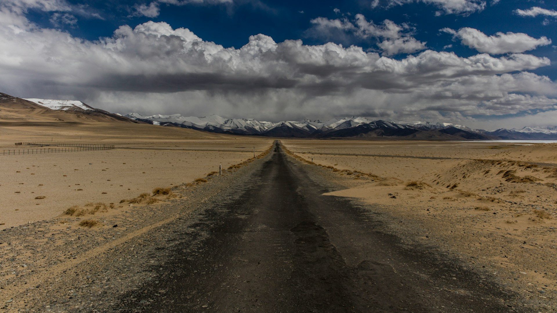
Culturally, the route also moves through three distinct worlds in nine days: the Soviet-era boulevards of Dushanbe, the Ismaili Pamiri villages and Silk Road forts of the Wakhan Corridor along the Afghan border, and the sparse, wind-scoured Kyrgyz herding settlements of the high eastern plateau around Murghab. That range is part of why this trip draws serious travelers well beyond the altitude-sport crowd, but it also means road quality, fuel availability, and cell coverage all decline the further east you go, which is a logistics factor as much as a health one.

Day-by-day plan
Day 1: Arrive Dushanbe
Land in Dushanbe (829 m/2,720 ft) and use the day to settle in, not sightsee hard. Walk Rudaki Avenue, visit the National Museum of Antiquities, and confirm your driver and vehicle for the week. You're at low elevation tonight; the altitude planning starts tomorrow.
Day 2: Dushanbe to Kalaikhum
A long first driving day, roughly 380 km and 9-10 hours, south through Kulob and then east along the Panj River, with Afghanistan visible across the water for most of the afternoon. Overnight in Kalaikhum (~1,300 m/4,265 ft). The elevation gain today is gradual and well within a safe range; the rough, winding road is more likely to cause motion sickness than altitude symptoms.
Day 3: Kalaikhum to Khorog
Continue along the Panj River gorge (~240 km) into Khorog (2,200 m/7,220 ft), the regional capital of Gorno-Badakhshan. The afternoon is free to walk the botanical garden, one of the highest-altitude botanical gardens in the world, and restock supplies before the road climbs further. This is a good checkpoint to confirm acetazolamide timing with your prescribing provider if you haven't started it yet.
Day 4: Khorog to the Wakhan Valley
Turn south into the Wakhan Corridor, tracing the Panj River with Afghanistan's Hindu Kush foothills across the water. Stop at Yamchun Fort and the Bibi Fatima hot springs, then overnight in Vrang or Langar (~2,600-2,800 m/8,530-9,185 ft). Sleeping altitude has climbed 400-600 m from Khorog, near the top of a single day's safe gain. Mild headache or reduced appetite tonight is common and not yet concerning at this elevation.
Day 5: Wakhan Valley to Murghab
The hardest driving and elevation day of the trip. Climb out of the Wakhan onto the open Pamir plateau via Khargush Pass (~4,344 m/14,250 ft, a same-day crossing, not an overnight), then continue roughly 300 km to Murghab (3,650 m/11,975 ft), the highest town in Tajikistan. This jump, 850-1,050 m of sleeping-altitude gain in a single day, runs well past CDC's graded-ascent guidance of no more than 500 m per day above 3,000 m. It's the one day on this route where that limit genuinely can't be respected without adding an extra overnight most travelers don't have time for, which is exactly why acetazolamide should already be active by this morning and why the next day is built as a full rest stop rather than another push forward.

Want the health prep for Tajikistan?
Get a 60-second pre-trip check: the vaccines, prescriptions, and altitude/seasonality notes that change the plan — built for your exact dates.
Day 6: Rest and acclimatize in Murghab
No net elevation change today, by design. Explore Murghab's Soviet-era shipping-container bazaar, walk out to the Aksu River, or take an optional day trip to Bulunkul, one of the coldest inhabited places in Central Asia, for views toward the Sarez region. This rest day is what makes day 5's jump survivable. If you're still symptomatic by evening (persistent headache, nausea, poor sleep), it's worth reassessing pace with your driver rather than continuing to Karakul the next morning.
Day 7: Murghab to Karakul via Ak-Baital Pass
A shorter driving day (~130 km) but the highest point of the entire trip: Ak-Baital Pass at 4,655 m/15,270 ft, the highest paved point anywhere in the former Soviet Union's road network. You'll spend roughly 20-30 minutes at the pass itself, a day-crossing rather than a sleeping elevation, which is the lower-risk way to touch extreme altitude. Descend slightly to overnight at Karakul Lake (~3,900 m/12,795 ft), a high-altitude salt lake formed by a meteorite impact, whose sleeping elevation is only a modest step up from Murghab and falls within a safe graded-ascent range after your rest day.
Day 8: Karakul back through Murghab to Khorog
A long descent day, retracing the route back through Murghab and Alichur and down into Khorog (2,200 m/7,220 ft), roughly 430 km. This is the single biggest elevation drop of the trip, over 1,700 m in one day, and it typically resolves any lingering altitude symptoms quickly. Expect fatigue from the driving itself rather than from altitude by evening.
Day 9: Khorog to Dushanbe, depart
Fly Khorog to Dushanbe (weather-dependent; the road alternative is 8-10 hours) for onward international connections. Flights on this route are frequently weather-cancelled given the terrain, so build in a buffer day if your onward international flight is tight.
Health prep for this trip
Start with a travel medicine consult 8 weeks out. CDC and travel-clinic guidance both flag typhoid, hepatitis A, and hepatitis B vaccination as recommended for most Tajikistan travelers, and rabies vaccination is worth discussing given the rural homestays and stray-dog presence typical of the Wakhan and Pamir plateau legs of this route. Malaria prophylaxis is not part of this trip's planning: WHO certified Tajikistan malaria-free in March 2023, with the country's last indigenous case recorded in 2014.
The altitude planning is the real work. CDC's Yellow Book notes that acute mountain sickness is common enough at moderate elevation to take seriously well before you reach this route's extremes; as an illustration of baseline risk, CDC data on Colorado visitors sleeping above roughly 2,450 m puts AMS incidence around 25%, and this itinerary spends three consecutive nights above 3,500 m, well past that reference point. Most travelers on this route should discuss acetazolamide with a provider, filled and dosed to be active by day 4's overnight in the Wakhan Valley, ahead of day 5's climb onto the plateau. Our Pamir Highway travel medicine kit bundles acetazolamide with ibuprofen for altitude headache and general aches, and hydroxyzine, useful for the sleep disruption that's common at 3,600-3,900 m and as a non-sedating option if you develop an allergic reaction in a remote homestay setting with no pharmacy nearby. Speak with a provider about dosing and any interactions with your existing medications before you go.
Hydration and pacing matter as much as any prescription. Alcohol in the first 48 hours above 3,000 m and heavy exertion on arrival at Murghab both worsen symptoms; mild activity only for the first day or two at each new elevation tier is the safer default. If you use caffeine regularly, keep your normal intake going rather than stopping cold on the road, a caffeine-withdrawal headache at 3,650 m is easy to mistake for altitude illness and will only add confusion to how you're tracking your own symptoms.
What to pack
A four-season sleeping bag or liner even where homestays provide bedding, layered insulation for nights that drop below freezing at Murghab and Karakul even in summer, a headlamp for villages running on limited generator power, sun protection (UV exposure climbs sharply above 3,500 m), lip balm and moisturizer for the dry plateau air, a paper map or offline GPS given the patchy cell coverage past Khorog, and your full medication kit in carry-on luggage rather than checked bags. Bring cash in Tajik somoni; there are no reliable ATMs past Khorog, and Murghab and the Wakhan Valley homestays are cash-only.
Best time to go and what to avoid
Outside the June-September window, road conditions on the eastern Pamir plateau become unpredictable enough that even experienced local drivers will often decline the Murghab-Karakul leg.
Cost expectations
Budget for a private driver and 4x4 for the full loop, homestay accommodation (basic but typically full-board) in Kalaikhum, Khorog, the Wakhan Valley, Murghab, and Karakul, and the Khorog-Dushanbe flight or return drive. Most travelers arrange the vehicle and driver as a package through a Khorog or Dushanbe-based operator rather than piecing together public transport, which is sparse and unreliable on the plateau sections. This is not a budget-backpacker route once you're past Khorog: fuel, driver time, and homestay logistics for nine days of remote plateau travel add up faster than a comparable trip in a more developed tourism corridor, and it's worth pricing the full package before committing to dates. Factor in your GBAO permit and e-visa fees separately, and build a one- or two-day buffer into your return flights given how often the Khorog-Dushanbe route gets weathered out.
Day-by-day plan
| Day | What you're doing | Health note |
|---|---|---|
| 1 | Arrive Dushanbe Land in Dushanbe (829 m/2,720 ft) and settle in before the road east. Walk the Rudaki Avenue area, visit the National Museum of Antiquities, and confirm your 4x4 and driver for the week ahead. | You're at low elevation tonight. Use today to hydrate well and get ahead of jet lag, not to sightsee hard. The altitude work starts tomorrow. |
| 2 | Dushanbe to Kalaikhum A long first driving day (roughly 380 km, 9-10 hours) south through Kulob and then east along the Panj River, with Afghanistan visible across the water for most of the afternoon. Overnight in Kalaikhum (~1,300 m/4,265 ft). | Gradual elevation gain today, well within a safe range. Expect rough, winding road; motion sickness is more likely than altitude symptoms on this stretch. |
| 3 | Kalaikhum to Khorog Continue along the Panj River gorge (~240 km) into Khorog (2,200 m/7,220 ft), the regional capital of Gorno-Badakhshan. Afternoon free to walk the botanical garden, one of the highest in the world, and stock up on supplies before the road climbs further. | Still a moderate elevation. Most travelers feel fine here, but this is a good day to confirm your acetazolamide timing with your prescribing provider if you haven't already started it. |
| 4 | Khorog to the Wakhan Valley Turn south into the Wakhan Corridor, tracing the Panj River with Afghanistan's Hindu Kush foothills across the water. Stop at Yamchun Fort and the Bibi Fatima hot springs before overnighting in Vrang or Langar (~2,600-2,800 m/8,530-9,185 ft). | Sleeping altitude has climbed roughly 400-600 m from Khorog, near the top of a safe daily gain. Watch for mild headache or reduced appetite tonight, both common and not yet concerning at this elevation. |
| 5 | Wakhan Valley to Murghab The hardest driving and elevation day of the trip. Climb out of the Wakhan onto the open Pamir plateau via Khargush Pass (~4,344 m/14,250 ft, a same-day crossing, not an overnight), then continue roughly 300 km to Murghab (3,650 m/11,975 ft), the highest town in Tajikistan. | This jump, roughly 850-1,050 m of sleeping-altitude gain in a single day, exceeds CDC's graded-ascent guidance of no more than 500 m per day above 3,000 m. It is the one day on this route where that limit cannot realistically be respected, which is exactly why acetazolamide should already be on board by this morning and why day 6 is a full rest day, not a driving day. |
| 6 | Rest and acclimatize in Murghab No net elevation change today by design. Explore Murghab's Soviet-container bazaar, walk out to the Aksu River, and take an optional day trip to Bulunkul, one of the coldest inhabited places in Central Asia, for views toward the Sarez region. | This is the acclimatization buffer that makes yesterday's jump survivable. If you're still symptomatic (persistent headache, nausea, poor sleep) by evening, this is the day to reassess pace with your driver rather than push on to Karakul tomorrow. |
| 7 | Murghab to Karakul via Ak-Baital Pass A shorter driving day (~130 km) but the highest point of the trip: Ak-Baital Pass at 4,655 m/15,270 ft, the highest paved point in the former Soviet road network. Descend slightly to overnight at Karakul Lake (~3,900 m/12,795 ft), a high-altitude salt lake formed by a meteorite impact. | You'll spend roughly 20-30 minutes at the pass itself, a day-crossing, not a sleeping elevation, which is the safer way to touch extreme altitude. Karakul's sleeping elevation is a modest step up from Murghab and sits within the graded-ascent range after your rest day. |
| 8 | Karakul back through Murghab to Khorog A long descent day, retracing the route back through Murghab and Alichur and down into Khorog (2,200 m/7,220 ft), roughly 430 km. | This is the single biggest elevation drop of the trip, over 1,700 m in one day, and it typically resolves any lingering altitude symptoms quickly. Expect fatigue from the drive itself rather than altitude by evening. |
| 9 | Khorog to Dushanbe, depart Fly Khorog to Dushanbe (weather-dependent; the alternate is an 8-10 hour drive) for onward international connections. | Flights on this route are frequently weather-cancelled given the terrain. Build in a buffer day if your onward international flight is tight, and don't plan the road option as a same-day backup without checking distances first. |
Frequently Asked Questions
Most travelers on this route should speak with a provider about acetazolamide before the trip. The CDC Yellow Book notes it can speed acclimatization when an abrupt ascent, like the Wakhan-to-Murghab day on this itinerary, is unavoidable. It's a prescription decision, not a given, and depends on your history with altitude.
Ak-Baital Pass, at 4,655 m (15,270 ft), the highest paved point in the former Soviet Union's road network. You cross it on day 7 as a same-day pass, not an overnight stop, which is the lower-risk way to touch that elevation.
No. The WHO certified Tajikistan malaria-free in March 2023, with the country's last indigenous case recorded in 2014. This itinerary's health planning is built around altitude, not malaria prevention.
Typhoid and hepatitis A are recommended for most travelers, hepatitis B is commonly recommended given regional prevalence, and rabies vaccination is worth a conversation if your trip includes rural homestays or close animal contact, both likely on the Wakhan and Pamir plateau legs of this route. Confirm your specific list with a travel medicine provider 6-8 weeks out.
Even in the June-September travel window, nighttime temperatures at Murghab (3,650 m) and Karakul (3,900 m) commonly drop below freezing. Pack for winter-weight sleeping and layering regardless of the calendar month.
Self-drive is possible with a rented 4x4 and a GBAO permit, but most travelers use a local driver given the road conditions, altitude, and remoteness between fuel and repair points on the eastern Pamir plateau.
The Wakhan Corridor is a well-established travel route with the Panj River as a natural border and no crossing into Afghanistan involved. Check current government travel advisories before booking, as regional conditions can shift.
A four-season sleeping bag or liner even if your homestay provides bedding, layered insulation, a headlamp (many Pamir plateau villages run on limited generator power), and any altitude medication in your carry-on rather than checked luggage.
Mark Karam, PA-C is a board-certified Physician Associate with emergency and urgent care experience and co-founder of Wandr Health.